HopFly Gravel
While there is no HopFly Gravel ride from the brewery this page lists known gravel rides in the Charlotte area. Gravel rides require a little extra planning since they are usually remote. Always bring repair items, food, water, and cell phone. Updated routes are on the Weekly Rides website or Carolina Gravel Facebook group.
Waxhaw Gravel King Info Here
For other gravel routes and events - please check Weekly Rides
Check out our Blog Post on Gravel!
To learn how to load TCX or GPX files to Garmin Click Here
or Easy Way 1: Attach Garmin to computer save GPX, FIT, or TCX to g:\Garmin\NewFiles\ where g is drive letter Garmin gets assigned
or Easy Way 2: Using Garmin Website and create route by importing GPX, TCX then on phone connect to device and select route - Save to Device
Courses:
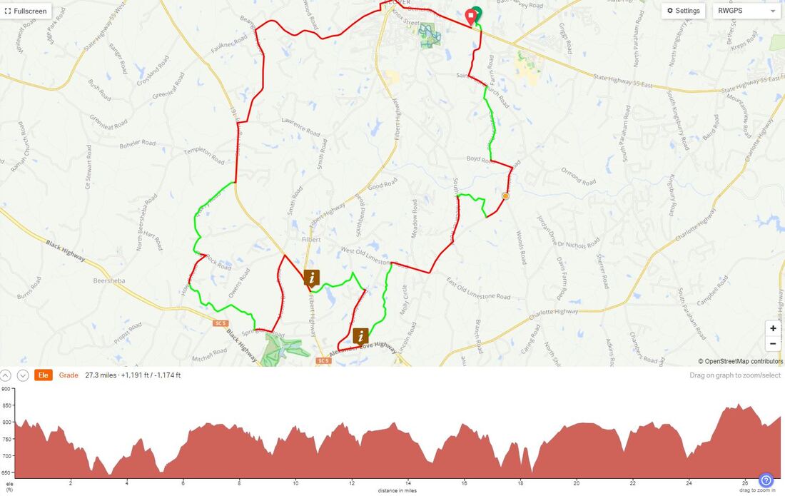
Clover 27, 47 and 57 Mile 2020/2021 Gravel Routes
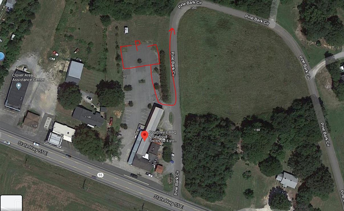
These interlocking rolling courses graduate in length and difficulty. The 27 mile course with 800 feet of climbing is a great place to get started in gravel. All rides start at Courtney's BBQ. Navigate to Courtney's Barbecue in Clover SC and park in the way back. You can also use the bathrooms in the front entrance of the restaurant. You should also plan on grabbing an Unknown beer and some barbecue after your ride. Check their Google Maps listing for hours.
These interlocking rolling courses graduate in length and difficulty. The 27 mile course with 800 feet of climbing is a great place to get started in gravel. All rides start at Courtney's BBQ. Navigate to Courtney's Barbecue in Clover SC and park in the way back. You can also use the bathrooms in the front entrance of the restaurant. You should also plan on grabbing an Unknown beer and some barbecue after your ride. Check their Google Maps listing for hours.
Unknown Clover 27 2020 (40/60)
https://ridewithgps.com/routes/34245129
Unknown Clover 47 2020 (40/60)
https://ridewithgps.com/routes/34245132
Unknown Clover 57 2020 (40/60)
https://ridewithgps.com/routes/34245127
Gravel and Glass 100 Mile Adventure (30/60)
Strava Route: https://www.strava.com/routes/2732074922406081612
GPX file: https://drive.google.com/file/d/1iU6BGolqHuazs6yHuv4ADK-FvXRvIuWy/view?usp=sharing
RWGPS With turn-by-turn: https://ridewithgps.com/routes/34524136
| cue_sheet_for_clover_27_unknown_gravel_w_cue.pdf | |
| File Size: | 529 kb |
| File Type: | |
|
|
| ||||||||||||||||||
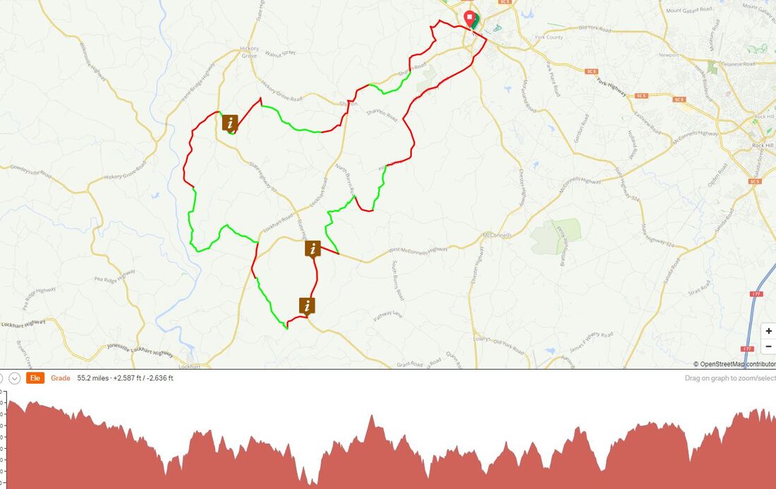
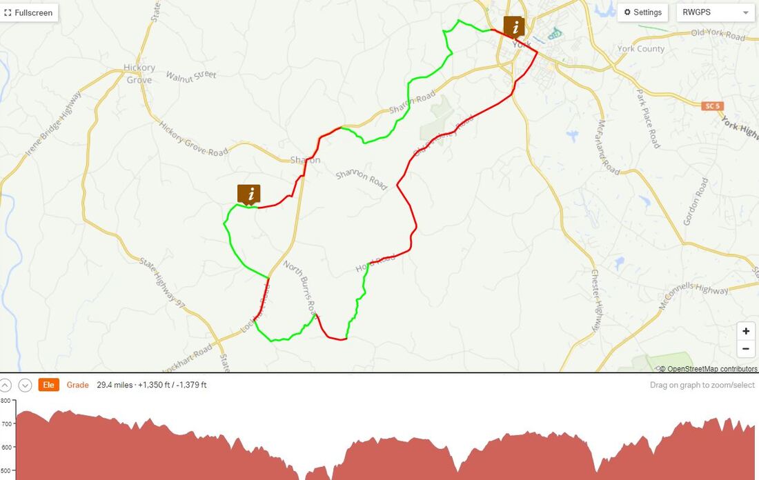
York SC HopFly Gravel! 30, 46 and 55 *New 2021
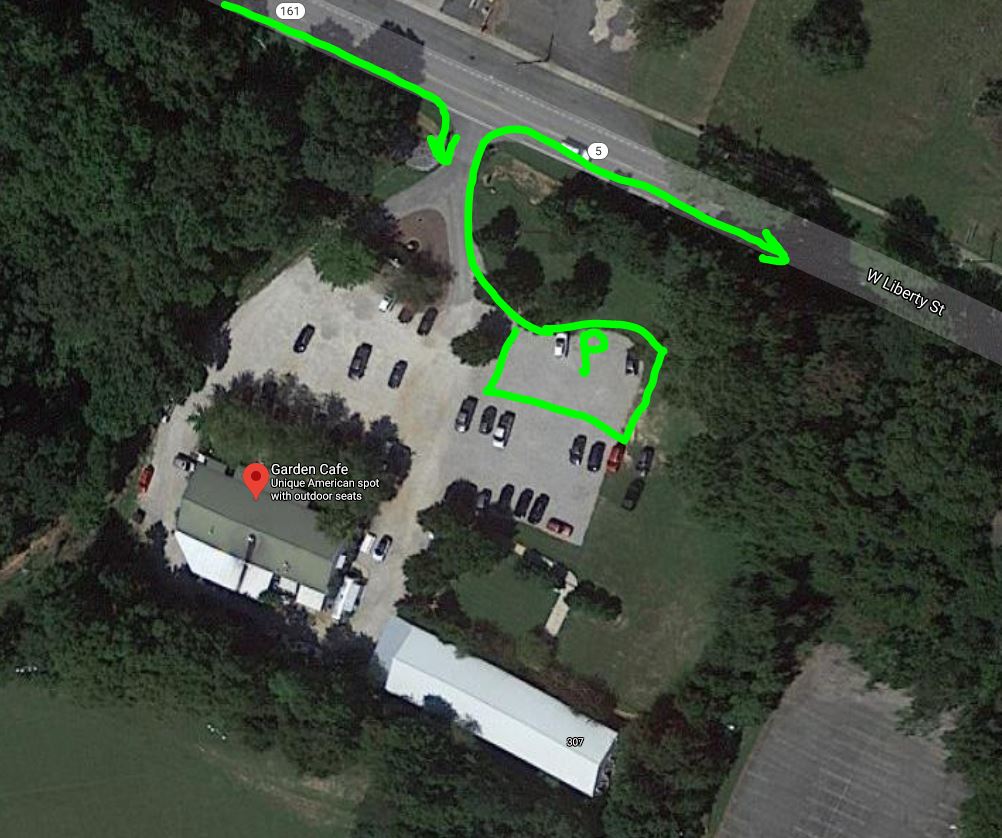
Choose between a rolling course 30, 46 or 55 mile course with 1500 or 3500 feet of climbing and over 40% type 1-2 gravel - really nice and about 40 minutes from Charlotte. Navigate to Garden Cafe 307 W Liberty St, York, SC 29745 - start and end this route from there. Watch for dogs at mile 18 and there is a small hike-a-bike section through what is now a closed road to cars at mile 38 - it is rideable.
Choose between a rolling course 30, 46 or 55 mile course with 1500 or 3500 feet of climbing and over 40% type 1-2 gravel - really nice and about 40 minutes from Charlotte. Navigate to Garden Cafe 307 W Liberty St, York, SC 29745 - start and end this route from there. Watch for dogs at mile 18 and there is a small hike-a-bike section through what is now a closed road to cars at mile 38 - it is rideable.
|
| ||||||||||||
New for 2022 the 46 mile version:
| hopfly_46_york.gpx | |
| File Size: | 163 kb |
| File Type: | gpx |
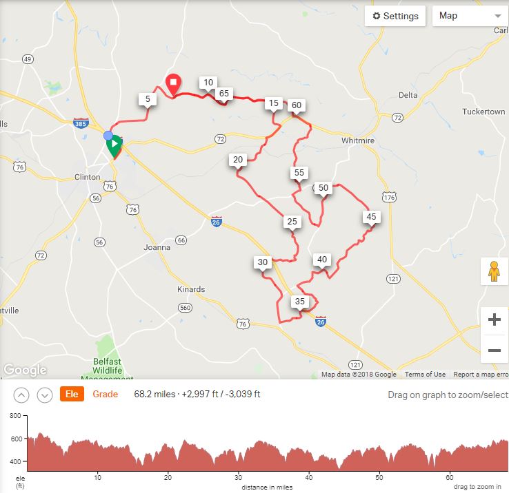
Boyd Cycling Sumter National Forest 50/50 - 68 or 38 Mile Routes
Sumter National Forest gravel - a 68 mile and 38 mile option for riders of all ability levels.
68 mile RidewithGPS route is here
38 mile RidewithGPS route is here
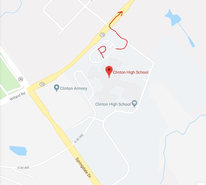
The course is rolling hills, very low traffic. Approximately 50% of the course is gravel. There is one river crossing, and two super cool tunnel underpasses going under I-26. Parking is at Clinton High School in Clinton, SC.
|
| ||||||||||||||||||||||||
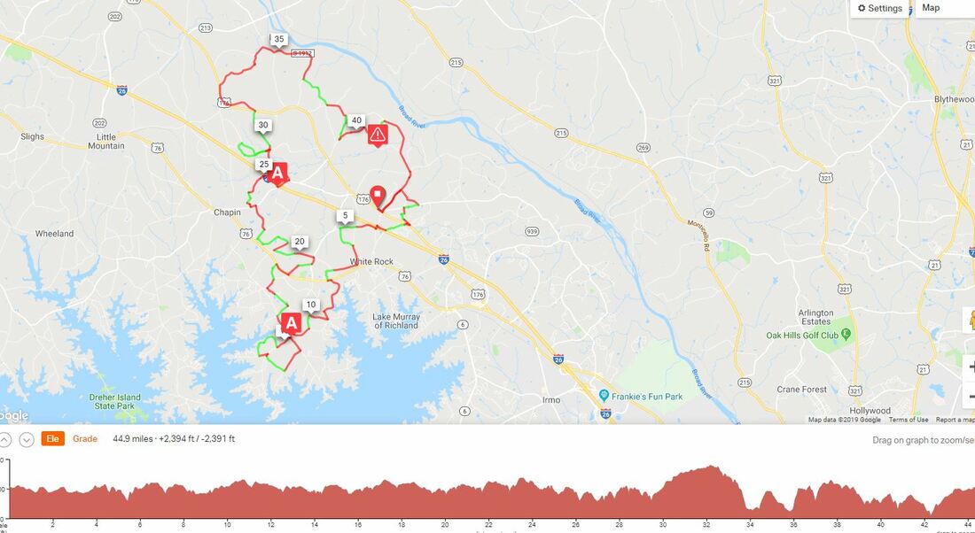
Chapin - Little Mountain SC 45 Gravel 50/50
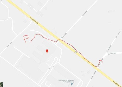
This enjoyable gravel road ride will take from Chapin, South Carolina to Little Mountain, SC and back. Rolling through farm land and rural back roads of Newberry and Richland County SC. The ride is on rough asphalt roads and approx. 20 miles of dirt and/or gravel roads. 2400 feet of elevation gain. Navigate to Spring Hill High School 11629 Broad River Road in Chapin SC. Thank you Maurice Smith for his research and route - check out his Meetup group Charlotte Area Cycling for other rides in the area.
This enjoyable gravel road ride will take from Chapin, South Carolina to Little Mountain, SC and back. Rolling through farm land and rural back roads of Newberry and Richland County SC. The ride is on rough asphalt roads and approx. 20 miles of dirt and/or gravel roads. 2400 feet of elevation gain. Navigate to Spring Hill High School 11629 Broad River Road in Chapin SC. Thank you Maurice Smith for his research and route - check out his Meetup group Charlotte Area Cycling for other rides in the area.
|
| ||||||||||||
* Always wear a helmet and ride safe checking these directions and conditions on the day of your ride. Information here is provided to the best of our knowledge and on as-is basis with no warranty explicit or implied.
